
Wednesday, March 31, 2010
John Bame and Fayetteville High School student look at old rail trestle and discarded rail ties blocking construction of city trail through old tunnel under existing Arkansas & Missouri Railroad
I might not have discovered this for some time had not John Bame brought some FHS students to World Peace Wetland Prairie and then taken them on a walk of the Pinnacle Prairie Trail and the part of Tsa-La-Gi Trail as yet uncompleted from the Hill Place Apartments through the old rail tunnel to the west to Razorback Road and beyond. Thanks to the environmentally aware students for caring and wanting to learn more about the delicate geography and geology of our city. Please click on image to enlarge view of railroad ties over mouth of tunnel and then watch video below the photo to learn reaction of workers when they learned that the ties should not be dumped there.
 Rail ties being dumped in mouth of tunnel in Fayetteville AR Aubrey james | MySpace Video The Fayetteville city trail administrator telephoned the railroad manager in Springdale an hour later and the railroad official confirmed that the ties were not to be dumped there but were to be dumped at Cato Springs Road. Rail ties are creosoted and very dangerous to human beings and other living things when the chemicals leach into the watershed.
Tuesday, March 30, 2010
UA students study urban streams and find Town Branch at 15th has the worst water quality of several studied: Thanks to developers and UA construction for that distinction
Please click on still photo to ENLARGE and click on video image to play.
 March 30, 2010 Aubrey james | MySpace Video

Friday, March 26, 2010
Highway Department plan to stop flow of sediment to Mulberry River from Pig Trail repair site will cost $1.6 million
Please click on byline of Adam Wallworth to go to newspaper online and view full story and previous stories on the pollution of Mountain Creek and the Mulberry River. See video by Tom Shuessler below. Click on video to find high-definition view on You Tube. Also, watch CAT 18 on Cox Cable at 11 a.m., 5 p.m. and 11 p.m. today for Schuessler's short slide show and description of what has been happening in recent weeks at the highway construction site on the Pig Trail (Arkansas 23). Programs on CAT also may be viewed simulcast online at www.catfayetteville.org at 11 a.m., 5 p.m. and 11 p.m. today. Click on WATCH ONLINE near right top corner of page.

Highway agency works to stem sediment flow into stream
Friday, March 26, 2010
LITTLE ROCK — State highway officials have begun work on a $1.6 million plan to stop the flow of sediment from an Arkansas 23 construction project into a Mulberry River tributary as state and federal environmental regulators consider penalties for the pollution.
“Even if they were to completely be able to remediate the site right now, that still doesn’t necessarily resolve any possible penalty,” said Ryan Benefield, deputy director of the Arkansas Departmentof Environmental Quality.
Benefield said the department will continue its enforcement action against the Arkansas Highway and Transportation Department while it reviews a mitigation plan that the agency submitted Wednesday.
The plan comes in response to reports by environmental inspector Jeff Tyler, who detailed runoff problems that caused sediment to flow into a tributary of Mountain Creek half a mile downhill from the Arkansas 23 construction site.
Tyler began monitoring the site after a resident about 5 miles downstream complained about sediment in Mountain Creek, which feeds the Mulberry River.
Heavy rains caused the collapse of a 1, 200-foot section of Arkansas 23, a 19-mile stretch also known as the Pig Trail Scenic Byway, in March 2008. A second collapse prompted the state to close the road in December after repair work had begun.
The Highway Department approved a $1.6 million change order to address runoff problems Wednesday.
Most of the mitigation cost - $1.3 million - stems from removing dirt and rocks from the roadbed and alongside Arkansas 23 where contractor Kesser International is rebuilding the road, said Randy Ort, Highway Department spokesman.
That waste material had been leveled, seeded and mulched, but then heavy rain caused it to start sliding, according to officials.
Kesser International has already started building a gravel road to accommodate the heavy equipment needed to remove the material, Ort said.
The flow of underground water that caused the road to collapse in the first place is causing the sediment-runoff problem, Ort said.
Repairs are intended to stabilize the hillside, but there is no guarantee there won’t be another slide.
“It’s going to happen again, maybe not here, but up there again,” Ort said. “We’ve had slides all over north Arkansas, but most don’t impair roadways.”
The mitigation plan also calls for digging a trench along the base of the roadway to direct rainwater into two natural channels, Ort said. The channels will be lined with rock, he said.
The hillside will be seeded and mulched, but until that vegetation takes hold, wattles will be used to control surface runoff. Wattles are similar to sandbags and are used to stop sediment while still allowing water to flow through.
Benefield said he expects his staff to submit a draft consent administrative order next week to outline steps the Highway Department and Kesser International need to take to fix the problem.
At a minimum, the order will require the Highway Department to implement its plan as submitted, Benefield said. The order could include additional remediation steps and a fine.
Biologists have said sediment 2- to 10-inches deep has choked out aquatic life in the tributary and in Mountain Creek, although the pollution dissipates quickly in the Mulberry River.
The U.S. Army Corps of Engineers is also pursuing enforcement action against the Highway Department and was expected to send a notice late Thursday or today, said Kyle Clark, chief of its enforcement branch and regulatory division.
Clark said the Highway Department will have 14 days to respond, but the Corps will likely accept any plan approved by the state environmental department.
State Sen. Ruth Whitaker, R-Cedarville, said she is waiting to hear back from Teresa Marks, director of the Department of Environmental Quality, and will continue to monitor the project. Whitaker questioned Highway Department officials about the runoff problem during the Legislature’s recent fiscal session.
Benefield said the consent administrative order will provide a legal framework to ensure that the Highway Department follows through with its plan and takes any needed future action. He said he expects the department to continue to cooperate.
Benefield couldn’t say whether the Highway Department has been subject to a consent administrative order before.
“I think it is fair to say it is uncommon, given the amount of work performed by the Highway Department,” he said.
Highway officials don’t plan to remove a portion of the spoil material that broke loose and slid into the tributary of Mountain Creek. Biologists have said removing that material could do more harm than good.
Arkansas, Pages 11 on 03/26/2010
Wednesday, March 24, 2010
Take a walk on the wildlife's side on April 18, 2010
Take a walk on the wildlife's side
OMNI Center for Peace, Justice and Ecology along with Town Branch Neighborhood and Friends of the World Peace Wetland Prairie invite the public to kick off the Earth Day week with a fun-filled family Earth Day Celebration from 1 to 5 p.m. Sunday, April 18, 2010, at World Peace Wetland Prairie in south Fayetteville.
This event promises to be a terrific way to start off a week-long observance of the worldwide 40th anniversary of Earth Day, specifically designated as April 22 in 1970.
Sing, play, get down and dirty at Mother Nature's knee. Stop and listen to the bird songs and watch the butterfly dances along the way.
Join the celebration of five years of being enriched by this special neighborhood park and public sanctuary for people and other living things in the Town Branch Watershed.
Music by Emily Kaitz, Still on the Hill and friends, seeds to spread and share, family fun and games, painting on the giant doodle pad, earth games and more will be offered.
The World Peace Wetland Prairie is a unique, neighborhood-developed and maintained, city-owned nature park at 1121 S. Duncan Avenue, Fayetteville, Arkansas.
Dedicated on Earth Day 2005, WPWP is a 2.5-acre parcel, a small remnant of the rich, dark prairie soil that historically existed in abundance on the the Ozark Plateau of Northwest Arkansas, nestled in an ecosystem transition zone between the Southern Great Plains and the Eastern Deciduous Forest.
A piece of oak savannah north of the original peace prairie has been added to the city park system and is accessible from the intersection of Duncan Avenue, Bacardi Avenue and 11th Street. On the west is a new stretch of paved city trail through Pinnacle Wet Prairie, which provides a spectacular display of native tall grass and wildflowers from May through October.
All three wetland areas are based on a depressed area that is a critical groundwater recharge area above a bedrock fault. Protecting such places is what low-impact development is all about.
Very few of these natural wet prairies exist today. They are disappearing to make room for urban developments that bring impervious surfaces and a foreign soil base, and an associated increase in stormwater runoff and needless siltation that destroys the native life in our streams and pollutes our water supply.
The bees responsible for the pollination of our food supply are being stressed by lack of habitat. WPWP and the Pinnacle Prairie provide a wide array of native plants on which they depend.
The unique Monarch butterflies must lay their eggs on the several species of milkweed on WPWP and Pinnacle Prairie and similar areas as they stop to reproduce new generations on their heroic annual journey from Mexico to Canada and back. If the milkweed disappears, monarch caterpillars will not grow, reproduction will stop and monarchs will no longer will exist.
Practically every species of beneficial insect depends on one or a few species for survival. The monarchs are simply the most dramatic example because of the long, multi-generational migration.
The acquisition of the World Peace Wetland Prairie was made possible by a partnership of the OMNI Center for Peace, Justice and Ecology, the City of Fayetteville, Audubon Arkansas, Tyson Foods, James Mathias Rentals, the Fayetteville Natural Heritage Association and the Town Branch Neighborhood Association. Its values demonstrate that every neighborhood and every home's yard should have a little nature garden of its own.
Directions:
From MLK Blvd. — Turn south on Hill Avenue, west on 11th Street, and curve south on South Duncan Avenue. WPWP is about 100 feet on the right.
From 15th Street — Turn north on South Duncan Avenue and travel past 12th St. WPWP is on the left.
www.worldpeacewetlandprairie.blogspot.com
www.worldpeacewetlandprairie.blogspot.com
All are welcome to this valuable opportunity to encounter Mother Nature's splendor and help make a difference in our shared environmental happiness, comfort and survival.
Please be aware of the presence of native, but hazardous and aptly named, poison ivy. It's suggested to bring gloves, clippers, green thumb, lawn chair, picnic, song or poem to share, hat, sunscreen and smiles. We are hoping for no need for umbrellas!
For more info contact the Friends of World Peace Wetland Prairie at: www.worldpeacewetlandprairie.com
or email: get_involved@worldpeacewetlandprairie.com
or by phone at 479-444-6072
News updates appear at http://worldpeacewetlandprairie.blogspot.com
Monday, March 22, 2010
Restore clean-water act to original strength Now!
Please double-click "view as webpage" link near top right to see full post.
I would like to express grave concern over the loss of protection for many of our small streams that provide clean drinking water for 117 million Americans in communities across the country. Supreme Court decisions in the Rapanos and Carabell cases have made it confusing and burdensome for the U.S. Environmental Protection Agency (EPA) and U.S. Army Corps of Engineers to protect small streams and wetlands under the Clean Water Act. As a result, enforcement actions against polluters have declined sharply the EPA estimates that over 1,000 cases have been shelved or dropped altogether. More recently it has become clear that some polluters are using the decisions as a justification to avoid any permitting and reporting requirements for discharging pollutants into our waters. For the Clean Water Act to fulfill its goal of restoring the chemical, physical, and biological integrity of the nation's waters, all waters must receive protection corresponding with Congress' original intent when passing this landmark law. Upstream waters must be protected from pollution and destruction if we expect downstream waters to be fit for swimming, drinking, and fish and wildlife, and downstream communities to be safe from flooding. I urge you to act in the interest of preserving clean water for healthy communities and wildlife. Please support introduction and passage of the Clean Water Restoration Act, which would clarify the definition of waters to eliminate uncertainty and ensure clean water in accordance with the goals of the Clean Water Act. Thank you for your consideration.
 | ||||||||
 To contact American Rivers, email us at outreach@AmericanRivers.org. To update your profile or change your preferences click here. To unsubscribe click here. To contact American Rivers, email us at outreach@AmericanRivers.org. To update your profile or change your preferences click here. To unsubscribe click here. American Rivers ©2010 | ||||||||

 Katherine Baer Senior Director, Clean Water Program
Water Champion Awardees listed
If you have trouble viewing this message click here to view it online.
First Annual Water Champion Awardees Announced
In honor of the United Nations' World Water Day, the World Water Monitoring Day™ program is pleased to announce the recipients of the first annual Water Champion awards. The Water Champion awards recognize superior levels of relevance, educational effort, support, and innovation in the promotion of water quality via involvement in World Water Monitoring Day.
Today the program honors the outstanding efforts of seven organizations and five individual participants for outreach conducted in 2009. Award recipients by geographical region are as follows:
Africa
Community Centred Conservation (C3)
Madagascar and Indian Ocean Islands Programme
C3 collaborated with local communities to conduct WWMD events at three coastal village locations in the Comoros and two coastal village locations in Madagascar. Click here to learn more.
Madagascar and Indian Ocean Islands Programme
C3 collaborated with local communities to conduct WWMD events at three coastal village locations in the Comoros and two coastal village locations in Madagascar. Click here to learn more.
Mr. Neakoh Mengyi
Mr. Mengyi coordinated 14 monitoring events in both the Ndonga Mantung and the Bui divisions of the North West Region, Republic of Cameroon. Click here to learn more.
Mr. Mengyi coordinated 14 monitoring events in both the Ndonga Mantung and the Bui divisions of the North West Region, Republic of Cameroon. Click here to learn more.
Asia
National Environmental Education and Research Foundation
NEER organized a two-day seminar for water quality stakeholders, donated test kits, and participated in monitoring activities that touched an estimated 700 schoolchildren in Western Uttar Pradesh and Delhi, India. Click here to learn more.
NEER organized a two-day seminar for water quality stakeholders, donated test kits, and participated in monitoring activities that touched an estimated 700 schoolchildren in Western Uttar Pradesh and Delhi, India. Click here to learn more.
Mr. Kalaimani Supramaniam
Mr. Supramaniam launched a large-scale campaign throughout Malaysia. With support from the state government of Kedah and local civic groups, his efforts touched over 50,000 people in 2009.Click here to learn more.
Mr. Supramaniam launched a large-scale campaign throughout Malaysia. With support from the state government of Kedah and local civic groups, his efforts touched over 50,000 people in 2009.Click here to learn more.
Australia/Oceania
Wollondilly Anglican College
WAC students conduct routine montoring of two sites along the Bargo River near their school in New South Wales, Australia. The group reports data collected to the local Streamwatch program.Click here to learn more.
WAC students conduct routine montoring of two sites along the Bargo River near their school in New South Wales, Australia. The group reports data collected to the local Streamwatch program.Click here to learn more.
Europe
Apa Canal 2000
Apa Canal 2000 (Pitesti and Arges County, Romania) has incorporated WWMD into their own public outreach program, donating test kits to 28 schools and facilitating monitoring at 142 sites. Click here to learn more.
Apa Canal 2000 (Pitesti and Arges County, Romania) has incorporated WWMD into their own public outreach program, donating test kits to 28 schools and facilitating monitoring at 142 sites. Click here to learn more.
Stepanavan Youth Center
Based in the Lori Region of Armenia, SYC engaged young adults in WWMD activities through its "Water and Youth" exchange program, including participants from Armenia, Georgia, Russia, Greece, and several other European countries. Click here to learn more.
Based in the Lori Region of Armenia, SYC engaged young adults in WWMD activities through its "Water and Youth" exchange program, including participants from Armenia, Georgia, Russia, Greece, and several other European countries. Click here to learn more.
North America
Jewish National Fund
With funding support from the U.S. Forest Service, JNF engages Jewish schools in the U.S. and Israel in the WWMD program. In 2009, the organization provided kits to 64 schools, bringing the total number of students reached since 2004 to over 19,000. Click here to learn more.
With funding support from the U.S. Forest Service, JNF engages Jewish schools in the U.S. and Israel in the WWMD program. In 2009, the organization provided kits to 64 schools, bringing the total number of students reached since 2004 to over 19,000. Click here to learn more.
Ms. Meg Tabacsko
On behalf of the New England Water Environment Association, Ms. Tabacsko has spearheaded the WWMD effort in New England (U.S.) for several years. In 2009, participation grew to involve 37 schools/groups, over 40 sites, and more than 1000 children. Click here to learn more.
On behalf of the New England Water Environment Association, Ms. Tabacsko has spearheaded the WWMD effort in New England (U.S.) for several years. In 2009, participation grew to involve 37 schools/groups, over 40 sites, and more than 1000 children. Click here to learn more.
South America
Escuela de Enseñanza Media N° 3007 "FIGHIERA"
The school (Sante Fe Province, Argentina) overcame shipping and scheduling obstacles to perform monitoring concurrently with groups in Spain and Sweden. Students shared their experiences through school papers and YouTube videos. Click here to learn more.
The school (Sante Fe Province, Argentina) overcame shipping and scheduling obstacles to perform monitoring concurrently with groups in Spain and Sweden. Students shared their experiences through school papers and YouTube videos. Click here to learn more.
Ms. Veronica Toledo
Working as an intern for WWMD partner COPAS-AquaSendas, Ms. Toledo was instrumental in expanding the coverage of the Chilean WWMD '09 initiative, particularly in the fjord region of southern Patagonia. Click here to learn more.
Working as an intern for WWMD partner COPAS-AquaSendas, Ms. Toledo was instrumental in expanding the coverage of the Chilean WWMD '09 initiative, particularly in the fjord region of southern Patagonia. Click here to learn more.
Friday, March 12, 2010
World Peace Wetland Prairie spider milkweed, false indigo bush, dogbane, blue-eyed grass and cottontail rabbit photographed on May 21, 2009
Please click on individual images to ENLARGE view of a sample of what you won't see on Earthday at World Peace Wetland Prairie but may see again if you visit in May. Native wildflowers and tall grass emerge later than the typical nonnative species found in many gardens in Arkansas.
 Photo above reveals view northwest with Amorpha fructicosa bush in bloom. Also known as false indigo or indigo bush on May 21, 2009, at World Peace Wetland Prairie.
  Cottontail rabbit reluctant to leave his grazing area and hoping photographer will back away on May 21, 2009, at World Peace Wetland Prairie.
  In photo above, the tiny blue-eyed grass is seen growing near a tall dogbane or Indian Hemp plant.
 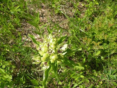 Above, Asclepias viridis, also known as spider milkweed or antelope horns, is nearing full bloom. Viridis is the earliest of the milkweeds to bloom in Northwest Arkansas.
  Above is an instance of a tall dogbane or Indian hemp plant with a shorter spider milkweed at right. Dogbane seems always to pop out of the ground before the milkweed and the leaves of the two are similar. Both are plentiful at World Peace Wetland Prairie. For more photos of wildflowers at WPWP, please see WPWP wildflowers

 Cottontail rabbit reluctant to leave his grazing area and hoping photographer will back away on May 21, 2009, at World Peace Wetland Prairie.

 Above is an instance of a tall dogbane or Indian hemp plant with a shorter spider milkweed at right. Dogbane seems always to pop out of the ground before the milkweed and the leaves of the two are similar. Both are plentiful at World Peace Wetland Prairie. For more photos of wildflowers at WPWP, please see WPWP wildflowers
Thursday, March 11, 2010
JOHN PENNINGTON OF THE Washington County Cooperative Extension Service and who is a member of our Land Use Planning and Green Infrastructuare Committee, HAS ASKED FOR VOLUNTEER HELP ON CLEAR CREEK:
Here's what John says:
"....... there are quite a few landowners with large
Please contact John at: 479-444-1770 or Jhpennington@uaex.edu
streamfront property acreage who are voluntarily implementing some
very large riparian buffers during the weeks of
March 15 -19 and 22-26.
I was wondering if any of you and some of your membership base would
be interested in helping me plant the trees along with these
landownners in either an "all-star approach" (a few people from a
few organizations per site - per day) or in an individual
organizational approach (one organization per site- per day).
I figure this is a great way for your organizations to not only
achieve a tiny smidge of your missions, make meaningful landowner
contacts, and increase membership, but to also help me out during a
time when I need some help from you or your organization."
ALSO----FROM THE ILLINOIS RIVER WATERSHED PARTNERSHIP------------------
To: "Contact IRWP" <contact@irwp.org>Subject: PLANT SEEDLINGS IN 2010: IRWP Riparian Project March 13, 2010
Join us in planting 3,000 seedlings at one of the six locations in the 2010 Illinois River Watershed Partnership Riparian Project!

Monday, March 8, 2010
Ask government to treat our rivers properly
| ||||||||
| ||||||||
| To contact American Rivers, email us at outreach@AmericanRivers.org. To update your profile or change your preferences click here. To unsubscribe click here. American Rivers ©2010 | ||||||||


Subscribe to:
Posts (Atom)